


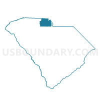
Springdale Voting District, York County, South Carolina
About
Outline

Summary
| Unique Area Identifier | 666984 |
| Name | Springdale Voting District |
| County | York County |
| State | South Carolina |
| Area (square miles) | 1.44 |
| Land Area (square miles) | 1.44 |
| Water Area (square miles) | 0.00 |
| % of Land Area | 99.91 |
| % of Water Area | 0.09 |
| Latitude of the Internal Point | 34.92377390 |
| Longtitude of the Internal Point | -80.97054080 |
Maps


Graphs
Select a template below for downloading or customizing gragh for Springdale Voting District, York County, South Carolina


Neighbors
Neighoring Voting District (by Name) Neighboring Voting District on the Map
- Anderson Road Voting District, York County, SC
- Hopewell Voting District, York County, SC
- Independence Voting District, York County, SC
- Manchester Voting District, York County, SC
- Neelys Creek Voting District, York County, SC
Top 10 Neighboring County Subdivision (by Population) Neighboring County Subdivision on the Map
Top 10 Neighboring Place (by Population) Neighboring Place on the Map
Top 10 Neighboring Unified School District (by Population) Neighboring Unified School District on the Map
Top 10 Neighboring State Legislative District Lower Chamber (by Population) Neighboring State Legislative District Lower Chamber on the Map
- State House District 45, SC (50,117)
- State House District 46, SC (40,384)
- State House District 43, SC (37,678)